Author


Article Highlights
- Smartphones and land-use maps reveal mobility patterns, housing conditions, and hospitalizations during NYC’s early pandemic
- People of color and low income were at higher risk due to frontline jobs and crowded homes
- Inequality in access to jobs and housing thus helps explain COVID-19 disparities
The dimensions of racial, ethnic, and income inequality in the United States have been laid bare by the COVID-19 pandemic. People of color and the poor have experienced much higher rates of infection and greater income declines from job loss. This reality was evident from the pandemic’s earliest days, particularly at its epicenter, New York City.
The mechanisms behind this harsh reality have been much debated. Early on, some suggested that variation in biological susceptibility was at play, a theory quickly discredited. Others laid blame on sheer density—that minorities live in relatively dense urban areas where social distancing is difficult. Research also suggested that public transportation was an important factor. Because people of color tend to be poorer than Whites, went the argument, they’re more likely to ride buses and subways, where they’re more likely to be infected.
In an Institute working paper, visiting scholar Milena Almagro of the University of Chicago argues that the culprits are not public transportation and urban density, per se. The roots are structural, she and her co-authors contend: Because minorities and those with less income are disadvantaged, they often work in frontline occupations and live in crowded homes. Both are risk factors for viral exposure and lead to higher rates of infection.
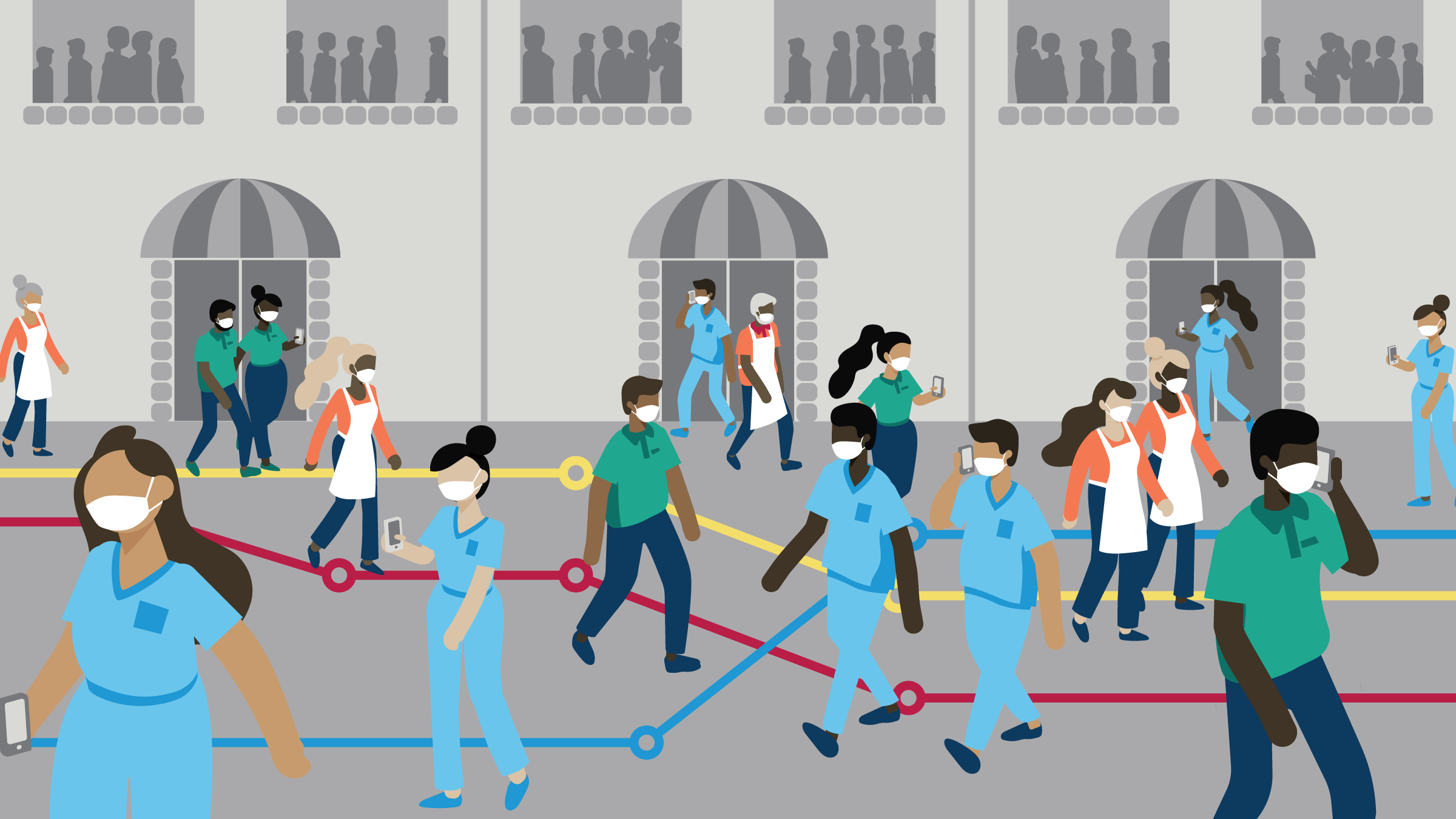
The theory is not novel, but the study provides some of the most substantive and detailed empirical backing for it and develops techniques that others will likely find valuable. The economists use anonymized cell phone pings to analyze mobility patterns in New York City between March and July 2020. They merge phone data with geospatial and building structure maps to measure housing density. With these data sets, they construct metrics on commuting patterns and housing conditions sorted by race, ethnicity, income, occupation, and other variables.
Their analyses show that people who lived in areas of the city that are disproportionately Black, Hispanic, and low-income tended to commute to their jobs and live in relatively crowded homes. Both commuting and crowding were linked at aggregate and individual levels to higher likelihood of extended hospitalization during a period when hospital beds were prioritized for COVID-19 patients.
The commute itself wasn’t the primary mode of contagion, argue the economists; rather, the commute indicated an occupation that was both essential and exposed—with potential for repeated virus infection. Contagion at home was the other key vector; crowded housing conditions raised the likelihood of transmission from family members and even nearby neighbors. Analysis shows that both risk measures—out-of-home mobility and in-home crowding—were key drivers of NYC pandemic patterns in the early weeks, though their relative strength varied over time.
The economists emphasize that urban density per se didn’t drive viral transmission. After all, Manhattan has greater density than other boroughs, but had a lower infection rate. Density matters only in context. “Temporary pockets of density created by the mobility patterns of frontline workers, and the physical proximity of housing crowding, matter more than a static picture of density,” the economists write. “Structural inequalities lead disadvantaged groups to disproportionately live in crowded housing and specialize in jobs that require physical presence, and therefore to increased COVID-19 exposure.”
Tracking commutes, homes, jobs, and illness
The scholars develop several large, intricate data sets and run multiple analyses, all focused on residents of the pandemic’s early epicenter, New York City. Anonymized cell phone data reveal day-time mobility and night-time home locations, as well as multiple-day hospital stays. Satellite images and government land use data provide numbers of residential units and their square footage. Combined with phone pings that indicate where individuals repeatedly stay at night (identifying their home), this yields a metric for housing crowding: average number of people per housing unit.
Hospitalizations are determined through multiple-day pings emanating from structures identified as hospitals via satellite images matched with federal infrastructure data. They focus on a one-month span, March 22 to April 22, when non-essential hospitalizations were postponed to prioritize COVID-19 patients. This hospitalization measure correlates well, they find, with actual hospitalization data from the New York Department of Health, indicating its validity as an indicator. The American Community Survey yields information on occupations and demographics; the researchers categorize jobs as flexible or nonflexible, and the latter as essential or non-essential.
Demographics and disease
The data reveal stark disparities, beginning with a substantial positive correlation between high average out-of-home mobility with high proportions of low-income, Black, and Hispanic individuals. Neighborhoods with high average home crowding are also correlated with neighborhoods with high shares of minorities and low-income individuals. Moreover, ZIP codes with higher shares of flexible occupations—that is, jobs than can be done from home—are strongly correlated with less mobility.
The relationship to COVID-19? The economists measure the statistical links between hospitalizations and the risk measures—home crowding and out-of-home mobility—and they do so at several levels, narrowing the analysis from ZIP code to building to individual. At each level, both risk measures are positively correlated with hospitalization.
For example, a 10 percent increase in hours outside a home census tract is associated with a 17.6 percent jump in daily average hospitalizations per unit.* A 10 percent increase in the number of people per housing unit corresponds to a 6.9 percent increase in average hospitalizations per unit. While racial and occupational disparities in hospitalization rates are evident in their data for New York, much of this inequality disappears after controlling for mobility and occupation, at least for Black and Asian populations. “This suggests that racial disparities in hospitalization rates, at least for these groups, can be accounted for by variation in background variables related to mobility and occupation.”
The data reveal an intriguing time trend for the importance of mobility and crowding. Worker mobility patterns had a large impact on hospitalization rates in late March. By mid-April, however, mobility had almost no influence, but home crowding was increasingly linked to hospitalization. In short, as businesses shut down and laid off employees, frontline exposure became less significant while contagion at home increased.
Up close and personal
To gauge the relationship at the individual level, the researchers estimate hospitalization “hazard rates” (essentially, the likelihood of being hospitalized) for each smartphone’s owner. Analysis at this very personal level provides further support for the notion that frontline occupations and crowded housing were major factors behind COVID-19 infection patterns.
A 1 percent increase in the number of hours spent outside one’s home tract increases the hazard rate for hospitalization by 45 percent, and a 1 percent increase in people at home means a 25 percent higher hazard rate. Looked at as an exposure distribution across New York’s population, the data show that a person at the 90th percentile of mobility—someone who frequently leaves home—has a hospitalization hazard rate four times that of a person at the 10th percentile. Having a flexible occupation was therefore hugely beneficial. But that was true only if the worker’s home wasn’t crowded. Those who lived in New York’s most crowded homes, the 90th percentile, faced a hospitalization hazard rate more than twice that of individuals at the 10th percentile.
Conclusion
The economists don’t draw policy implications, but the paper’s takeaways are clear. Structural inequalities related to job requirements and housing conditions mean that low-income people and minorities, in New York City at least, faced greater exposure to contagion and COVID-19 in the early days of the pandemic. “Underlying inequalities in access to jobs and housing explain the racial disparities in outcomes,” they write. “Crowding at home and exposure at work, rather than density, best explain the inequities of disease burden through the pandemic.”
Endnotes
* Census tracts are smaller than ZIP code areas; tract-level analysis is therefore more geographically specific. Where useful for analysis, the economists aggregate tracts into ZIP codes using a “crosswalk” file that maps their interrelationship.