Authors


Article Highlights
- Innovative resource expands access to community-level data on variety of topics
- Place-based tool visualizes summary statistics across Indian Country, maps key infrastructure
- Profiles aim to support Native communities in telling their stories
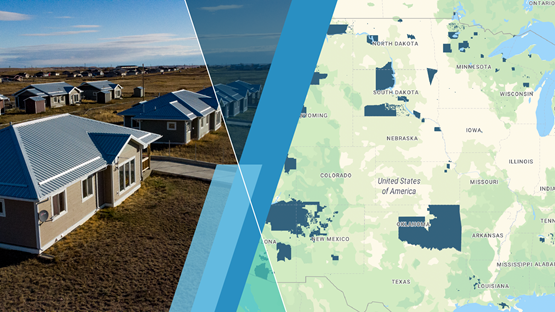
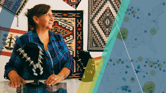
A recently released data tool from the Center for Indian Country Development (CICD) offers information about Indian Country’s places and people in a new, integrated way. Native Community Data Profiles expands access to relevant and robust public data that can help create a holistic picture of Native communities. Tribal leaders, policymakers, grant writers, and anyone interested in gaining insight into Indian Country can use the tool to explore a community’s economic conditions, opportunities, and infrastructure.
Native Community Data Profiles gathers information from more than a dozen public sources in an easy-to-use interactive tool, providing key summary statistics and qualitative information about a variety of topics. The tool presents information for individual Native communities as well as all Native geographies and the United States as a whole. For example, the tool can tell you that across all Native geographies, the share of households that have access to high-speed Internet is 57.8 percent, compared to 72.0 percent in the United States as a whole. The tool also maps key infrastructure. The Flathead Reservation profile, for instance, provides a map of the seven Indian Health Service facilities located within the reservation and shows that the health care and social assistance industry employs the most workers.
Closing data gaps
In an economy in which information is power, data gaps deeply affect Indian Country. Publicly available data, where they exist, are scattered across many sources of information. Rarely do geographic data focus specifically on Indian Country; reporting is often at the county or census-tract level, though Native geographies exist independent of those lines. Information resources may include basic demographic and economic indicators but lack comparisons and context. With wide variation in Native economies and governance structures, state- or national-level statistics may be too general to aid local decision-making. Hard-to-use formats and technical jargon can limit data access.
These gaps have left Indigenous communities with unmet needs for high-quality, geographically specific data that incorporate the unique features of Indian Country in a centralized location. With Native Community Data Profiles, CICD aims to reduce harmful data gaps by providing an accessible resource for storytelling and decision-making across Indian Country.
Exploring Native geographies
Visitors to Native Community Data Profiles are greeted by a searchable map and eight topic areas. The tool opens to a randomly selected Native geography, and visitors can choose their community of interest from the drop-down menu. Interactive pop-ups explain what each data point means, with clickable links to relevant external websites where available.
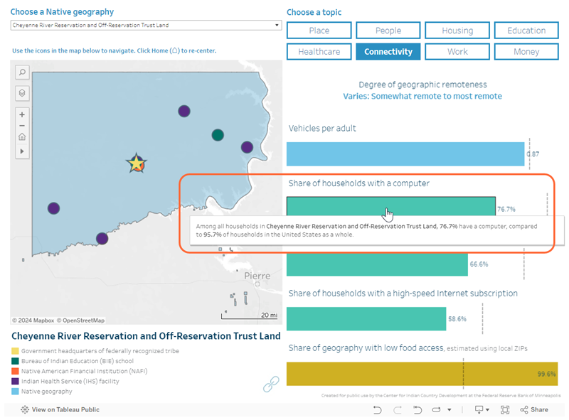
Let’s say a tribal citizen wants to build a greater understanding of connectivity in their community. As shown in the image below, they can select the “Connectivity” tab to learn about access to technology, transportation, food, and other resources, alongside comparisons to national-level statistics. For example, after selecting the Cheyenne River Reservation via the drop-down menu, they can see that the share of households with a computer in that community is 76.7 percent. By hovering over that statistic, they’ll find the national comparison.
Now, let’s say a non-Native community member is curious about what Native communities are nearby and wants to learn more. After selecting “All available Native geographies” in the drop-down menu, they can use the navigation tools on the map. To zoom in on an area, they can enter a city, state, or ZIP Code into the search box. Nearby Native geographies appear in blue highlights. Selecting a Native geography in the drop-down menu will then populate its profile.
The new tool, which launched in December 2023, expands the information previously available in CICD’s Reservation Profiles—this tool’s predecessor—from 77 federally recognized American Indian reservations with populations of 2,500 or more to all 704 Native geographies currently tabulated by the U.S. Census Bureau. Native geographies such as state-recognized reservations, Hawaiian Home Lands, Alaska Native Village Statistical Areas, and joint-use areas are now represented. Where applicable, the tool also shows headquarter locations of state- and federally recognized tribes. Two new aggregated views—“All available Native geographies” and “All federal reservations, off-reservation trust lands, and joint-use areas”—provide comparison data for broader swaths of Indian Country.
Key features and data details
A range of stakeholders shared perspectives that helped shape Native Community Data Profiles. For example, users of CICD’s 2017 Reservation Profiles resource regularly requested updates and enhancements. In developing the new tool, we also sought input from our Leadership Council and other stakeholders through sessions at Indian Country events. We relied on our Principles for Research and Data Use to guide design choices, as with other CICD data work. The goal of gathering diverse viewpoints in developing the new tool—and continuing to refine it—is to provide a resource informed by the real-world needs of tribal governments, economic and policy practitioners, and anyone seeking to use data to advance Native economic self-determination and prosperity.
This stakeholder input is reflected in the breadth of data compiled from more than a dozen public sources, including the American Community Survey (ACS), U.S. Department of the Interior Bureau of Indian Affairs, U.S. Department of Agriculture, and National Center for Education Statistics. Where needed, we used geographic overlap methods to translate data reported for geographic units such as counties and ZIP Codes to Native geographies. When information was scattered, unstandardized, or available only in hard-to-access formats, we curated it to create usable datasets. For example, we manually gathered information on tribes’ self-governance status and compiled a comprehensive list of state-recognized tribes from state government sources—the first in over a decade.*
In addition to statistical measures, the tool presents a broader view of Native communities’ surrounding landscapes, both environmental and institutional. The “Place” topic provides information on a community’s land area, water area, and climate. The map depicts a community’s Native-centered institutions, such as Native American Financial Institutions and tribal colleges and universities. In mapping services made available by and to Native peoples, Native Community Data Profiles serves as a dynamic resource that reflects aspects of community life and enhances understanding of the ways in which Native nations exercise their inherent sovereignty.
Comparisons help put numbers in context and make meaning. Where available, the tool presents statistics for a Native geography’s Native-identifying population, entire population, and the United States as a whole. Geographic context informs which comparisons are provided. For example, when a Hawaiian Home Land is selected, data points adjust from American Indian and Alaska Native comparisons to Native Hawaiian statistics.
A number of features are intended to support users’ individual data needs and help them find related information. Interested visitors can make custom comparisons and conduct their own analyses by downloading the spreadsheet linked below the data tool. Visitors can share a particular data view via email or social media by clicking the “Share” icon in the lower right corner. By clicking the “Download” icon near it, they can also export images for use in reports and slide decks. Clicking the “Link” icon below a profile’s map takes visitors to complementary tools from the U.S. Census Bureau that provide a deeper dive into that community’s ACS data.
CICD plans to update Native Community Data Profiles annually. Visitors interested in learning more about data sources and methods can do so in About the Data.
A living resource
Native Community Data Profiles complements other CICD data tools designed to organize and share information with an Indian Country focus and context. Together, these tools increase the accessibility of high-quality data to support the economic self-determination and prosperity of Native nations and Indigenous communities.
The tool will continue to evolve based on stakeholder input and the availability of new data. We encourage visitors to our data resources to share their experiences and feedback at cicd.data@mpls.frb.org. We also invite your suggestions for additional information and features that would be valuable. In collaboration with our stakeholders across Indian Country, CICD looks forward to continuing to cultivate information resources that support Native communities in telling their stories.
Endnotes
* The National Congress of American Indians’ Tribal Directory served as a valuable cross-reference as we compiled state documentation.
Vanessa Palmer is the data director for the Federal Reserve’s Center for Indian Country Development (CICD), where she leads efforts to collect, harmonize, and sustainably manage research-ready data in support of economic self-determination in Indian Country. In addition, she uses statistical tools and data visualization to support CICD’s applied research work.